Spatial data layer
Introduction
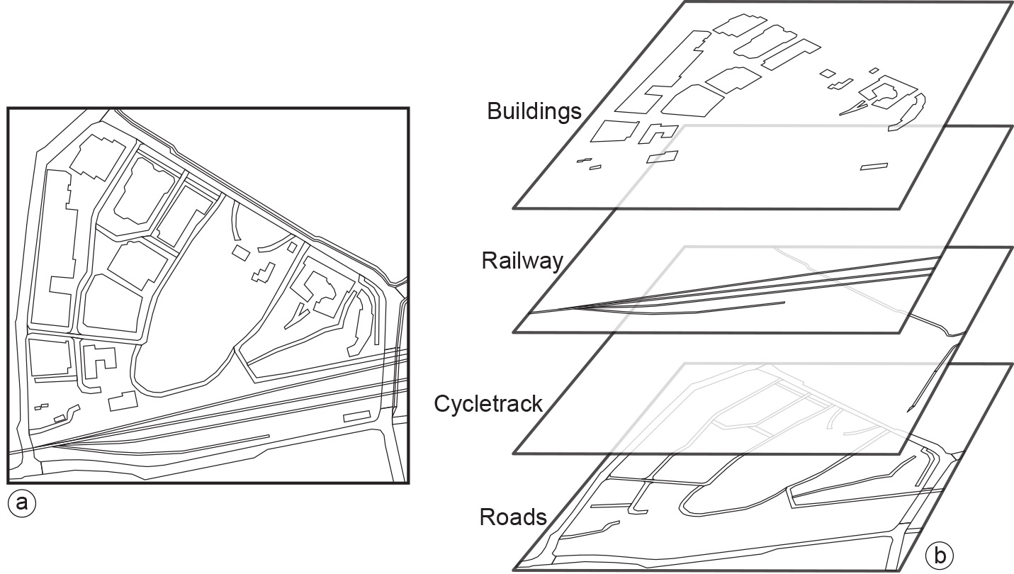
A spatial data layer is either a representation of a continuous or discrete field, or a collection of objects of the same kind. The main principle of data organization applied in a GIS is that of spatial data layers. Usually, the data are organized such that similar elements are in a single data layer (Figure 1). For example, all telephone booth point objects would be in one layer, and all road line objects in another. A data layer contains spatial data, as well as attribute (i.e. thematic) data, which further describes the field or objects in the layer. Attribute data are quite often arranged in tabular form, maintained in some kind of geo-database.
Explanation
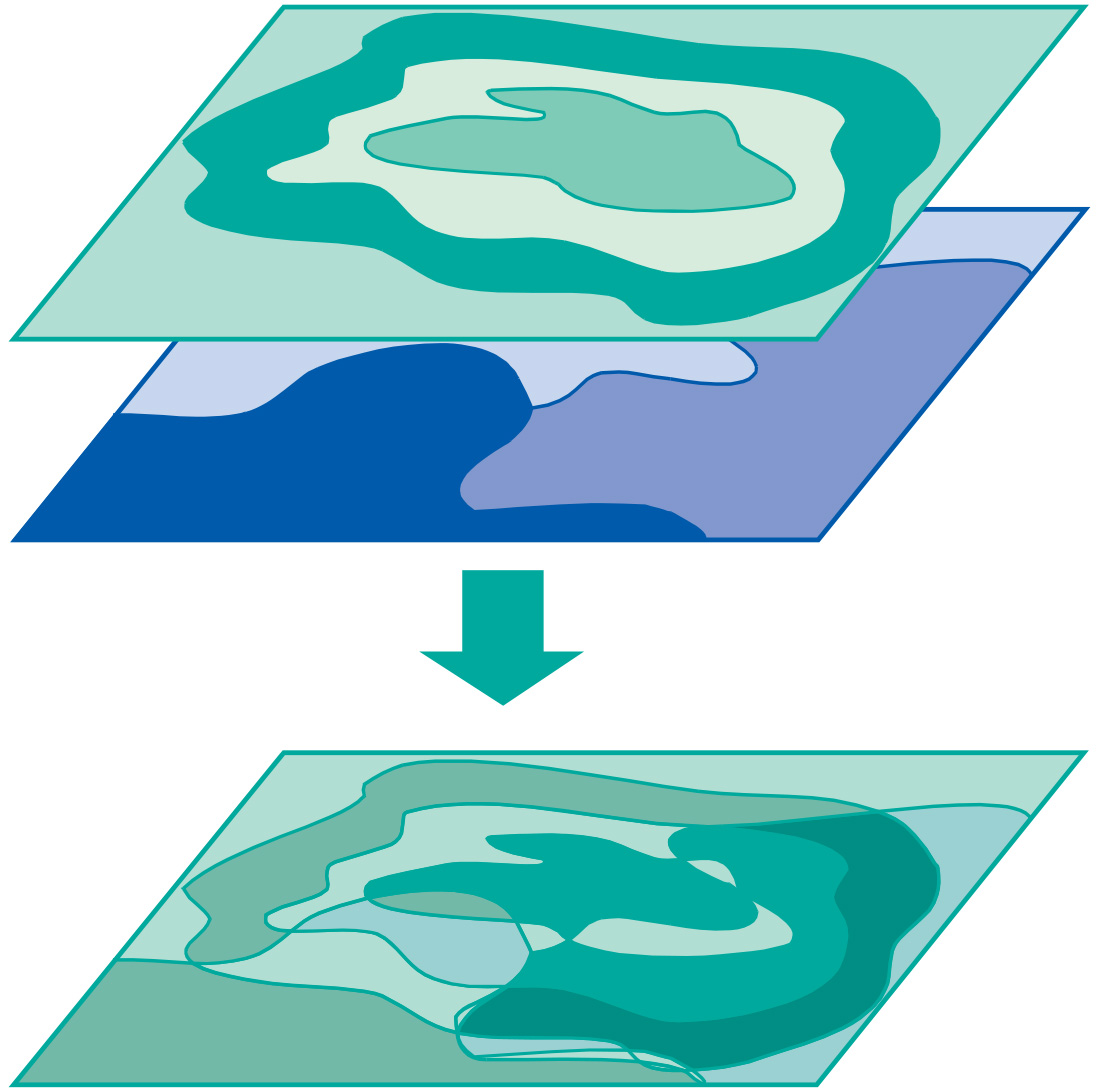
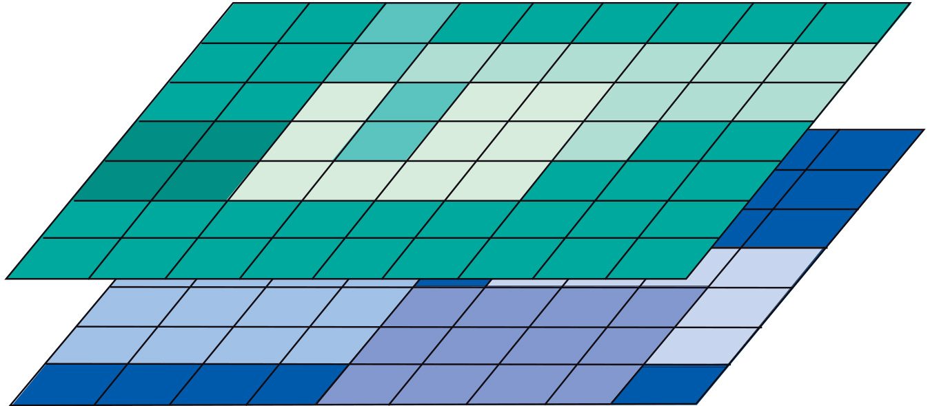
Data layers can be laid over each other, inside a GIS package, to study combinations of geographic phenomena. We shall see that a GIS can be used to study the spatial correlation between different phenomena, albeit requiring computations that overlay one data layer with another. This is schematically depicted in Figure 2 for two different object layers. Field layers can also be involved in overlay operations (Figure 3).
For a more detailed discussion of the functions offered for data management by GISs and database systems, refer to Database Management Systems (DBMS).
Learning outcomes
-
2 - Spatial data modelling: computer representations
Explain and be able to apply basic vector and raster spatial data structures including selecting a suitable data structure for geographic phenomena (level 1, 2 and 3).
Prior knowledge
Outgoing relations
- Spatial data layer is a kind of Data
- Spatial data layer is based on Spatial data acquisition
- Spatial data layer is modelled by Geographical representation
- Spatial data layer is processed by GIS
Incoming relations
- Positional accuracy is a property of Spatial data layer
- Continuous Field is represented by Spatial data layer
- Discrete Field is represented by Spatial data layer
- Geographic object is represented by Spatial data layer
- Spatial Reference System is used by Spatial data layer
- Topological relationship is used by Spatial data layer