Discrete Field
Introduction
Discrete fields divide the study space in mutually exclusive, bounded parts, with all locations in one part having the same field value. Discrete fields are intermediate between continuous fields and geographic objects: discrete fields and objects both use “bounded” features.
Explanation
Discrete fields divide the study space in mutually exclusive, bounded parts, with all locations in one part having the same field value. Typical examples are land classifications, for instance, using either geological classes, soil type, land use type, crop type or natural vegetation type. An example of a discrete field - in this case identifying geological units in the Falset study area - is provided in the Figure. Observe that locations on the boundary between two parts can be assigned the field value of the “left” or “right” part of that boundary.
Discrete fields are intermediate between continuous fields and geographic objects: discrete fields and objects both use “bounded” features. A discrete field, however, assigns a value to every location in the study area, which is not typically the case for geographic objects. These two types of fields differ in the type of cell values. A discrete field such as land use type will store cell values of the type “integer” and is therefore also called an integer raster. Discrete fields can be easily converted to polygons since it is relatively easy to draw a boundary line around a group of cells with the same value. A continuous raster is also called a “floating point” raster.
A field-based model consists of a finite collection of geographic fields: we may be interested in, for example, elevation, barometric pressure, mean annual rainfall and maximum daily evapotranspiration, and would therefore use four different fields to model the relevant phenomena within our study area.
Examples
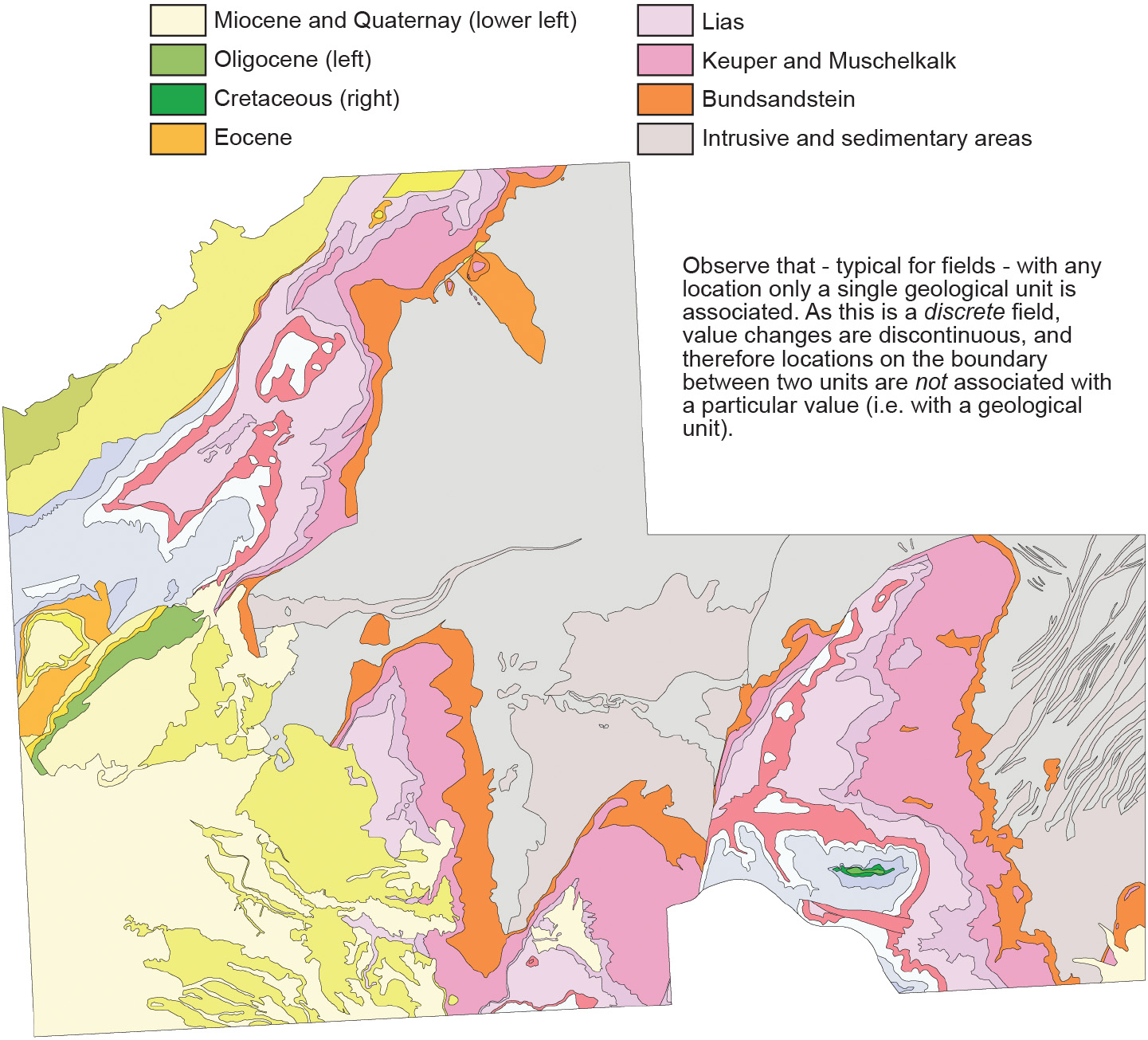
The area is approximately 25x20 km. Observe that - typical for fields - with any location only a single geological unit is associated. As this is a discrete field, value changes are discontinuous, and therfore locations on the boundary between two units are not associated with a particular value (i.e. with a geological unit).
Learning outcomes
-
1 - Spatial data modelling: geographic phenomena
Explain what geographic phenomena are, their spatial and temporal aspects and the relationship between the type of phenomena and their computer representation (level 1 and 2 according to Bloom’s taxonomy).
Prior knowledge
Outgoing relations
- Discrete Field is a kind of Geographic field
- Discrete Field is modelled by Regular Tessellation
- Discrete Field is modelled by Vector Representation
- Discrete Field is represented by Spatial data layer
Incoming relations
- Boundaries is used by Discrete Field