Positional accuracy
Introduction
The surveying and mapping profession has a long tradition of determining and minimizing error. Measurement errors are generally described in terms of accuracy. The general ways of quantifying positional accuracy is by using
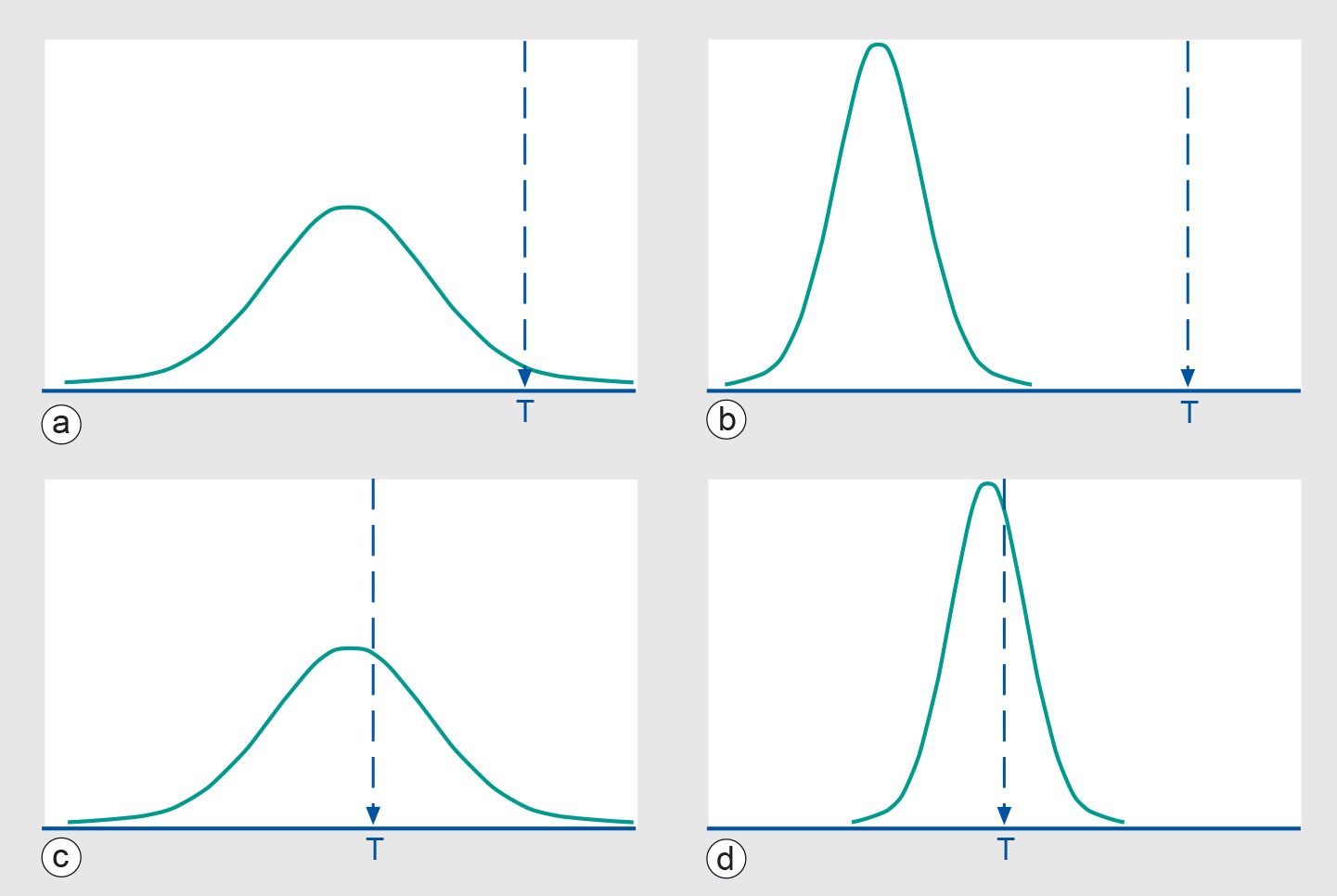
Accuracy should not be confused with precision, which is a statement of the smallest unit of measurement to which data can be recorded. In conventional surveying and mapping practice, accuracy and precision are closely related. Instruments with an appropriate precision are employed, and surveying methods chosen, to meet specified tolerances in accuracy. In
The relationship between accuracy and precision can be clarified using graphs that display the probability distribution (see below) of a measurement against the true value T. In the Figure below, we depict the cases of good/bad accuracy against good/bad precision.
Learning outcomes
-
15 - Data quality: quality assessment
Student is abel to explain and apply quality assessment procedures (level 1, 2 and 3).
Prior knowledge
Outgoing relations
- Positional accuracy is a property of Spatial data layer
- Positional accuracy is based on Sources of errors
- Positional accuracy is defined by Precision
- Positional accuracy is defined by Uncertainty
- Positional accuracy is measured by Perkal band
- Positional accuracy is measured by RMSE
- Positional accuracy is part of Accuracy