Vectorization
Introduction
Another set of techniques also works from a scanned image of the original map, but uses a GIS to find features in the image. These techniques are known as semi-automatic or automatic digitizing, depending on how much operator interaction is required. If vector data are to be distilled from this procedure, a process known as Vectorization follows the scanning process. This procedure is less labour-intensive but can only be applied for relatively simple sources.
The process of distilling points, lines and polygons from a scanned image is called vectorization. Vectorization produces a vector data set from a raster. Another form of vectorization is used when we want to identify features or patterns in remotely sensed images.
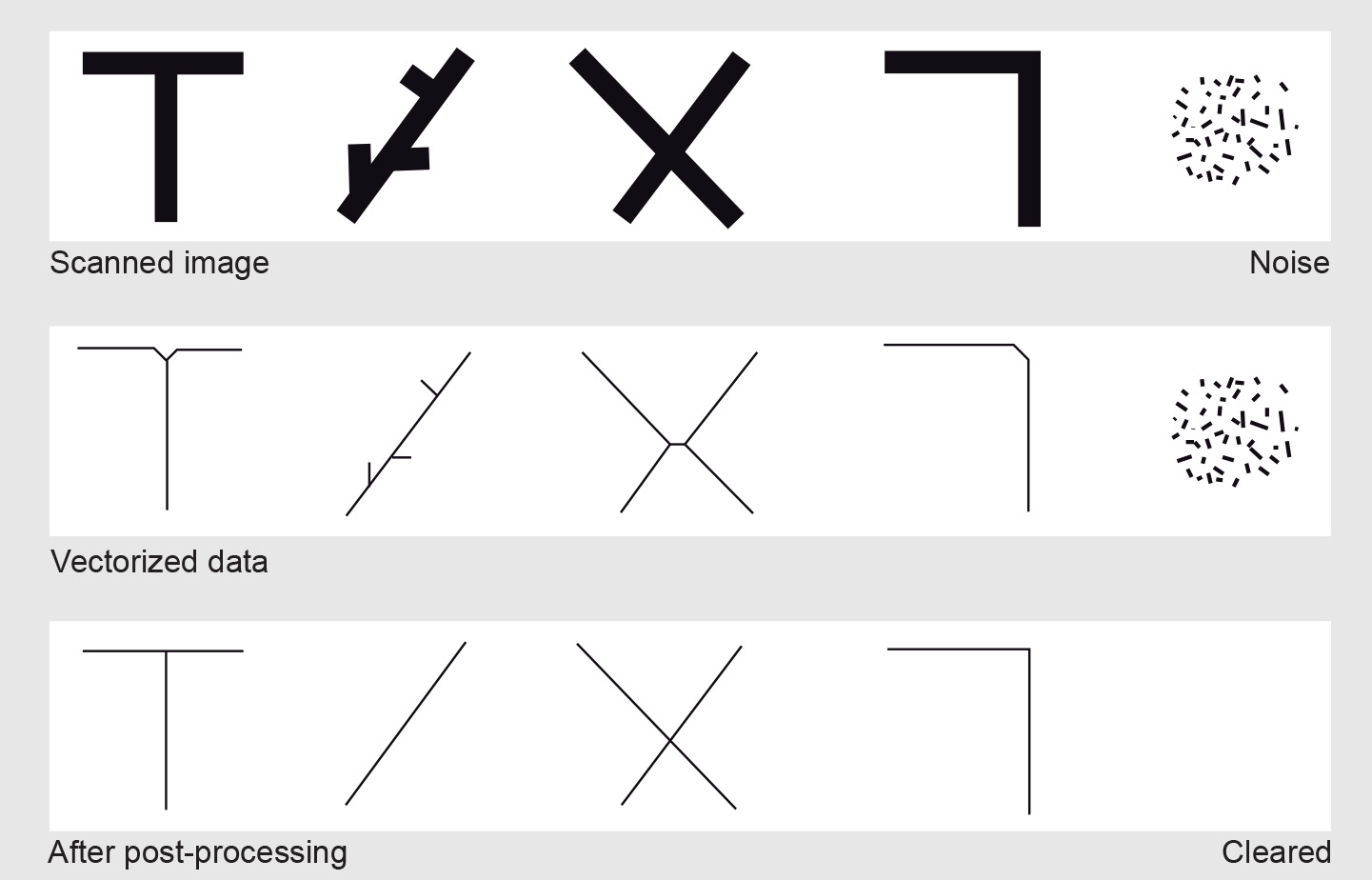
As scanned lines may be several pixels wide, they are often first thinned to retain only the centreline. The remaining centreline pixels are converted to series of (x, y) coordinate pairs, defining a polyline. Subsequently, features are formed and attributes are attached to them. This process may be entirely automated or performed semi-automatically, with the assistance of an operator. Pattern recognition methods - like Optical Character Recognition (OCR) for text - can be used for the automatic detection of graphic symbols and text.
Vectorization causes errors such as small spikes along lines, rounded corners, errors in T- and X-junctions, displaced lines or jagged curves. These errors are corrected in an automatic or interactive post-processing phase. The phases of the vectorization process are illustrated in Figure above.
Learning outcomes
-
9 - Data entry: data input techniques
Describe and explain standard spatial (and non-spatial) data input techniques (non RS) including the management of the data collection process (level 1 and 2).
Prior knowledge
Outgoing relations
- Vectorization is a kind of Data checks and repairs
- Vectorization is a kind of Digitizing