Data checks and repairs
Introduction
Data checks and repairs refers to the step when acquired data sets must be checked for quality in terms of the accuracy, consistency and completeness. Often, errors can be identified automatically, after which manual editing methods can be used to correct the errors. Alternatively, some software may identify and automatically correct certain types of errors. The geometric, topological, and attribute components of spatial data can be distinguished.

“Clean-up” operations are often performed in a standard sequence. For example, crossing lines are split before dangling lines are erased, and nodes are created at intersections before polygons are generated (Figure 1).
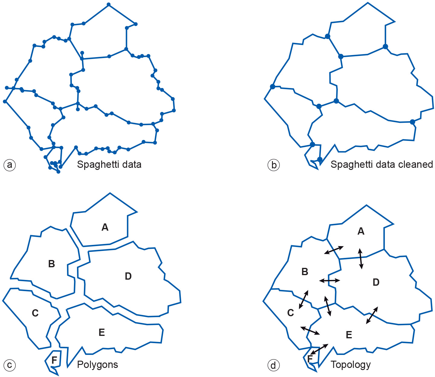
With polygon data, one usually starts with many polylines (in an unwieldy format known as spaghetti data) that are combined and cleaned in the first step (Figure 2a-b). This results in fewer polylines with nodes being created at intersections. Then, polygons can be identified (Figure 2c). Sometimes, polylines that should connect to form closed boundaries do not, and must, therefore, be connected either manually or automatically. In a final step, the elementary topology of the polygons can be derived (Figure 2d).

Learning outcomes
-
14 - Data quality: data handling
Identify the impact of Geo-information handling on data quality (level 1).
Prior knowledge
Outgoing relations
- Data checks and repairs is a kind of Data preparation
Incoming relations
- Associating attribute is a kind of Data checks and repairs
- Rasterization is a kind of Data checks and repairs
- Topology generation is a kind of Data checks and repairs
- Vectorization is a kind of Data checks and repairs