Mobile GIS
Introduction
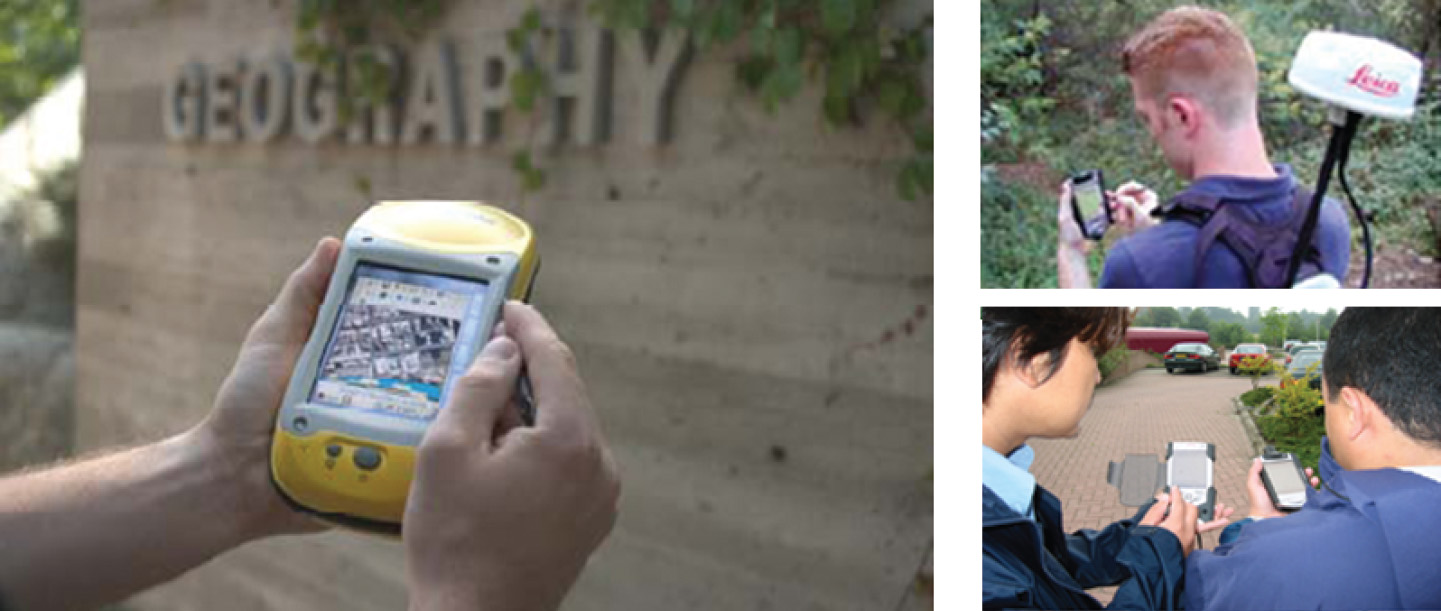
Until recently, printed maps and forms were taken to the field and the information collected was sketched as notes on the map or written down on a form. This information was entered into a GIS database after returning to the office. This method of data collection is inefficient and prone to error. With a mobile GIS system and the support of a satellite receiver, we can take a
Explanation
Professional applications for mobile
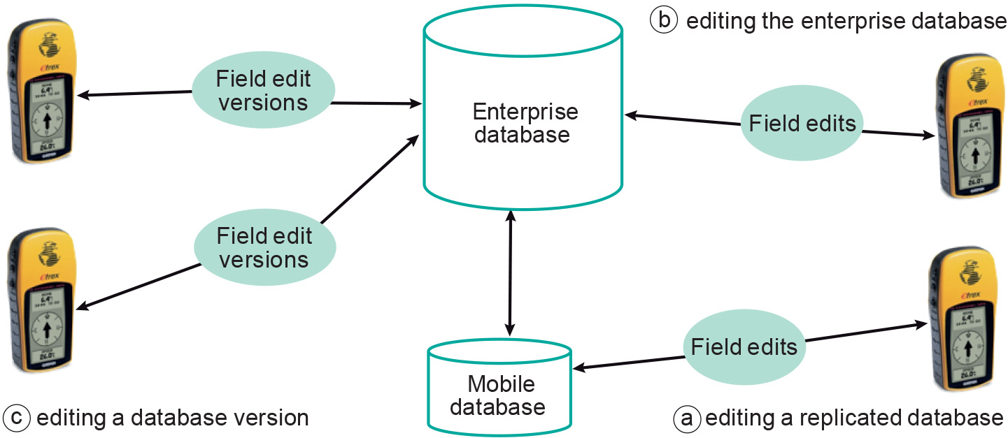
A simple task-driven mobile application begins in the office. GIS data are extracted from the main database and mapped onto the mobile device to be used in the field. The updated data are uploaded after returning to the office (Figure 2a).
A high-end mobile
In cases where there is no connection to the main database in the office (e.g. a firewall makes access impossible), field edits can be synchronized later, when access to the main database is provided (Figure 2c) . A versioned transaction may take care of the situation that the same feature (in the field) is updated several times: it can compare the updates (reconciling the version edits) before transferring the feature to the main, or parent, database.
Learning outcomes
-
9 - Data entry: data input techniques
Describe and explain standard spatial (and non-spatial) data input techniques (non RS) including the management of the data collection process (level 1 and 2).
Prior knowledge
Outgoing relations
- Mobile GIS is a kind of Terrestrial surveys