Local vertical datum
Introduction
Local vertical datums are locally defined by registering the ocean’s water level at coastal locations over several years using tide gauges (mareographs). Averaging the registrations largely eliminates variations in sea level over time. The resultant water level represents a local vertical datum, also called mean sea level. It is an approximation to the Geoid.
Several definitions of local vertical datums appear throughout the world. They are parallel to the Geoid but offset by up to a couple of metres to allow for local phenomena such as ocean currents, tides, coastal winds, water temperature and salinity at the location of the tide gauge.
Care must be taken when using heights from another local vertical datum. This might be the case, for example, in areas along the border of adjacent nations. The local vertical datum is implemented through a levelling network, which consists of benchmarks whose height above mean sea level has been determined through geodetic levelling .
Explanation
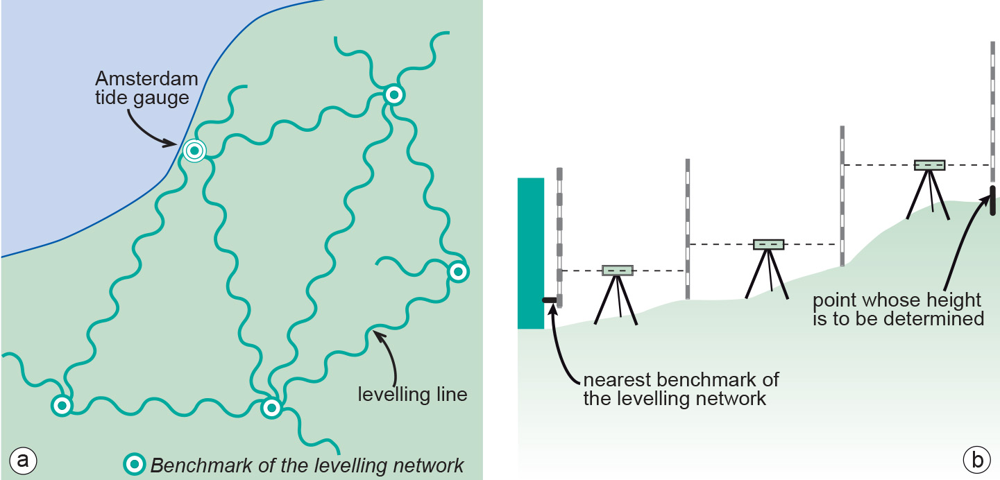
The local vertical datum is implemented through a levelling network, which consists of benchmarks whose height above mean sea level has been determined through geodetic levelling .Even within a country, heights may differ depending on the location of the tide gauge to which mean sea level is related. As an example, the mean sea level from the Atlantic to the Pacific coast of the U.S.A. differs by 0.6–0.7 m. The tide gauge (zero height) of the Netherlands differs -2.34 m from the tide gauge (zero height) of neighbouring Belgium.
The implementation of the datum enables easy user access. Surveyors, for example, do not need to start from scratch (i.e. from the Amsterdam tide gauge) each time they need to determine the height of a new point. They use the benchmark of the levelling network that is closest to the new point.
As a result of satellite gravity missions, it is currently possible to determine height (H) above the Geoid to centimetre levels of accuracy. It is foreseeable that a global vertical datum may become ubiquitous in the next 10–15 years. If all geodata, for example maps, were to use such a global vertical datum, heights would become globally comparable, effectively making local vertical datums redundant for users of geoinformation.
Examples
For the Netherlands and Germany, local mean sea level is related to the Amsterdam Tide Gauge (zero height). We can determine the height of a point in Enschede with respect to the Amsterdam Tide Gauge using a technique known as geodetic levelling. The result of this process will be the height of the point in Enschede above local mean sea level. Height determined with respect to a tide gauge station is known as orthometric height (height H above the Geoid).
Even within a country, heights may differ depending on the location of the tide gauge to which mean sea level is related. As an example, the mean sea level from the Atlantic to the Pacific coast of the U.S.A. differs by 0.6–0.7 m. The tide gauge (zero height) of the Netherlands differs -2.34 m from the tide gauge (zero height) of neighbouring Belgium.
Synonyms
local height datum
Learning outcomes
-
7 - Coordinate systems and map projections
Explain the relevance of reference surfaces, coordinate systems, and coordi-nate transformations in mapping (level 1 and 2).
Prior knowledge
Outgoing relations
- Local vertical datum is a kind of Vertical datum
Incoming relations
- Mean sea level is a kind of Local vertical datum