Reference surface
Introduction
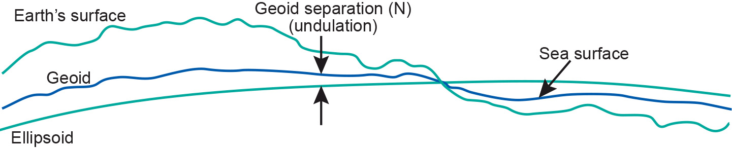
A reference surface is a datum that provide a reference point to the Earth's surface. There are horizontal datums, that describe the position on the Earth's surface and vertical datums that describe elevation. Two main reference surfaces have been established to approximate the shape of the Earth: one is called the Geoid, the other the Ellipsoid.
The surface of the Earth is far from uniform. Its oceans can be treated as reasonably uniform, but the surface or topography of its land masses exhibits large vertical variations between mountains and valleys. These variations make it impossible to approximate the shape of the Earth with any reasonably simple mathematical model.
Learning outcomes
-
7 - Coordinate systems and map projections
Explain the relevance of reference surfaces, coordinate systems, and coordi-nate transformations in mapping (level 1 and 2).
Incoming relations
- Ellipsoid is a kind of Reference surface
- Geoid is a kind of Reference surface
- Mean sea level is a kind of Reference surface
- Sphere is a kind of Reference surface