Local horizontal datum
Introduction
Local horizontal datums are reference surfaces (ellipsoids) that apply to a specific country or localized area of the Earth’s surface.
An ellipsoid is positioned and oriented with respect to the local mean sea level by adopting a latitude (ϕ) and longitude (λ) and ellipsoidal height (h) of what is called a fundamental point and an azimuth to an additional point. We say that this defines a local horizontal datum. Note that the term horizontal datum and geodetic datum are treated as equivalent and interchangeable terms.
Explanation
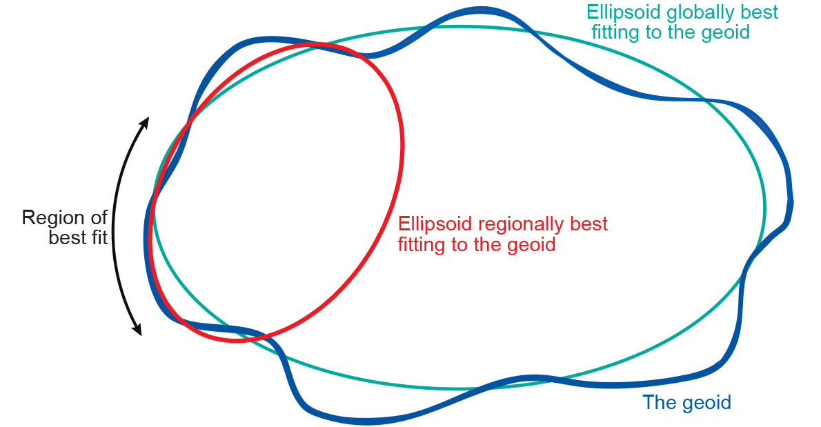
The Local Horizontal Datum or Local ellipsoids have been established to fit the Geoid (mean sea level) well over an area of local interest, which in the past was never larger than a continent (Figure 1). This meant that the differences between the Geoid and the reference ellipsoid could effectively be ignored, allowing accurate maps to be drawn in the vicinity of the datum.
A local horizontal datum is determined through a triangulation network (see Figure 2 for an example). Such a network consists of monumented points that form a network of triangular mesh elements. The angles in each triangle are measured, in addition to at least one side of the triangle; the fundamental point is also a point in the triangulation network. The angle measurements and the adopted coordinates of the fundamental point are then used to derive geographic coordinates (ϕ, λ) for all monumented points of the triangulation network.

Within this framework, users do not need to start from scratch (i.e. from the fundamental point) in order to determine the geographic coordinates of a new point. They can use the monument of the triangulation network that is closest to the new point. The extension and re-measurement of the network is nowadays done through satellite measurements.
Examples
Several hundred local horizontal datums exist in the world. The reason for this is obvious: different local ellipsoids of varying position and orientation had to be adopted to provide a best fit of the local mean sea level in different countries or regions. The Potsdam Datum, the local horizontal datum used in Germany is an example of a local horizontal datum. The fundamental point is located in Rauenberg and the underlying ellipsoid is the Bessel ellipsoid (a = 6,377,397.156 m, b = 6,356,079.175 m). We can determine the latitude and longitude (ϕ, λ) of any other point in Germany with respect to this local horizontal datum using geodetic positioning techniques, such as triangulation and trilateration. The result of this process will be the geographic (or horizontal) coordinates (ϕ, λ) of a new point in the Potsdam Datum.
Synonyms
local geodetic datum
Learning outcomes
-
7 - Coordinate systems and map projections
Explain the relevance of reference surfaces, coordinate systems, and coordi-nate transformations in mapping (level 1 and 2).
Prior knowledge
Outgoing relations
- Local horizontal datum is a kind of Horizontal datum