Query
Introduction
When exploring a spatial data set, the first thing one usually wants to do is select certain features, to (temporarily) restrict the exploration. Such selections can be made on geometric/spatial grounds or on the basis of attribute data associated with the spatial features.
Selection conditions on attribute values can be combined using logical connectives such as AND, OR and NOT. Other techniques of selecting features can also usually be combined. Any set of selected features can be used as the input for a subsequent selection procedure. This means, for instance, that we can select all medical clinics first, then identify roads within 200 m of them, then select from those only the major roads, then select the nearest clinics to these remaining roads as the ones that should receive our financial support for maintenance. In this way, we are combining various techniques of selection.
Interactive Spatial Selection
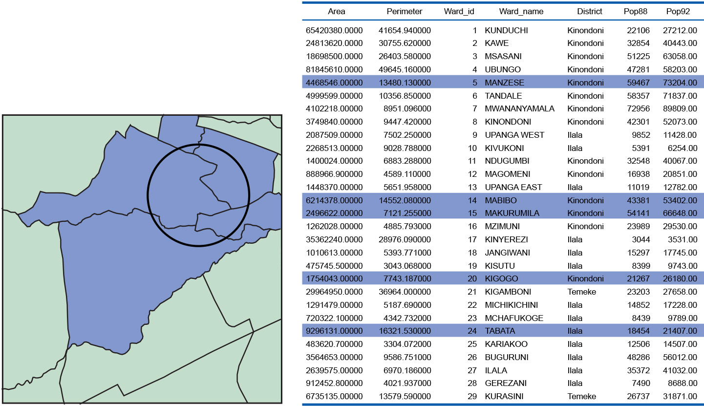
In interactive spatial selection , one defines the selection condition by pointing at or drawing spatial objects on the screen display, after having indicated the spatial data layer(s) from which to select features. The interactively defined objects are called the selection objects; they can be points, lines, or polygons. The GIS then selects the features in the indicated data layer(s) that overlap (i.e. intersect, meet, contain, or are contained in;) with the selection objects. These become the selected objects.
Interactive spatial selection answers questions like “What is at …?” IN the Figure below, the selection object is a circle and the selected objects are the blue polygons; they overlap with the selection object.
Learning outcomes
-
11 - Spatial analysis: classes of functions
Classify and explain spatial analysis functions (measurements, classification, overlay, neighbourhood and connectivity) in a raster and vector environment (level 1 and 2).
Prior knowledge
Outgoing relations
- Query is a kind of Analysis
- Query is modelled by Querying a spatial database with SQL
- Query is used by Vector Representation
Incoming relations
- Attribute projection is a kind of Query
- Selection based on spatial relationships is a kind of Query
- Selection by attribute conditions is a kind of Query
- Selection by attributes is a kind of Query
- Selection of records is a kind of Query
- Spatial database is related to Query