Digitizing
Introduction
A traditional method of obtaining spatial data is through digitizing existing printed maps. This can be done using on-tablet and on-screen manual digitizing. Before adopting this approach, one must be aware that positional errors already on the map will further accumulate and that one must be willing to accept these errors.
Explanation
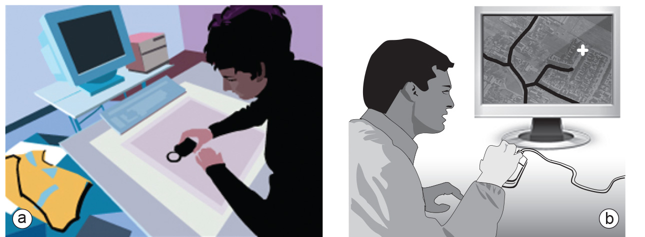
There are two forms of digitizing: on-tablet and on-screen manual digitizing (Figure below). In on-tablet digitizing, the original map is fitted on a special surface (the tablet), while in on-screen digitizing, a scanned image of the map (or some other image) is shown on the computer screen. In both of these forms, an operator follows the map’s features (mostly lines) with a mouse device, thereby tracing the lines, and storing location coordinates relative to a number of previously defined control points. The function of these points is to “lock” a coordinate system onto the digitized data: the control points on the map have known coordinates, so by digitizing them we tell the system implicitly where all other digitized locations are. At least three control points are needed, but preferably more should be digitized, to allow checking for any positional errors.

How to
Selecting a digitizing technique
The choice of digitizing technique depends on the quality, complexity and contents of the input document. Complex images are better manually digitized; simple images are better automatically digitized. Images that are full of detail and symbols - such as topographic maps and aerial photographs - are therefore better digitized manually. Images that show only one type of information (e.g. elevation contours) are better automatically digitized.
In practice, the optimal choice may be a combination of methods. For example, contourline film separations can be automatically digitized and used to produce a
Learning outcomes
-
9 - Data entry: data input techniques
Describe and explain standard spatial (and non-spatial) data input techniques (non RS) including the management of the data collection process (level 1 and 2).
Prior knowledge
Outgoing relations
- Digitizing is a kind of Spatial Data Collection
Incoming relations
- Map is related to Digitizing