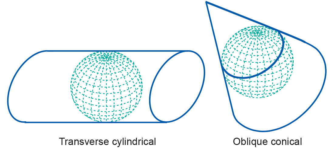
Projections by aspect
Introduction
Projections can also be described in terms of the direction of the projection plane's orientation (whether cylinder, plane or cone) with respect to the globe. This is called the aspect of a map projection. The three possible aspects are normal, transverse and oblique. In a normal projection, the main orientation of the projection surface is parallel to the earth's axis (as in the figure below for the cylinder and the cone). A transverse projection has its main orientation perpendicular to the earth's axis. Oblique projections are all other, non-parallel and non-perpendicular, cases.

Examples
The Universal Transverse Mercator (UTM) is a system of map projection that is used worldwide. It is derived from the Transverse Mercator projection (also known as Gauss-Kruger or Gauss conformal projection). UTM uses a transverse cylinder secant to the horizontal reference surface. It divides the world into 60 narrow longitudinal zones of 6 degrees, numbered from 1 to 60. The narrow zones of 6 degrees (and the secant map surface) make the distortions small enough for large-scale topographic mapping.
Normal cylindrical projections are typically used to map the world in its entirety. Conical projections are often used to map individual continents, whereas the normal azimuthal projection may be used to map polar areas. Transverse and oblique aspects of many projections can be used for most parts of the world
Learning outcomes
-
7 - Coordinate systems and map projections
Explain the relevance of reference surfaces, coordinate systems, and coordi-nate transformations in mapping (level 1 and 2).
Prior knowledge
Outgoing relations
- Projections by aspect is a kind of Projection classification