Projection class
Introduction
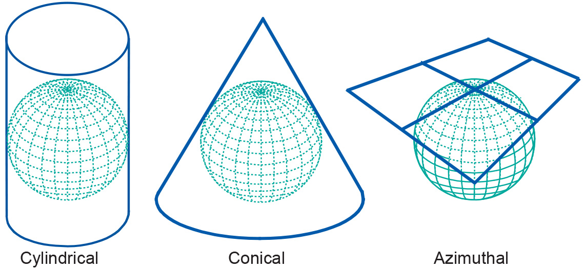
Some map projections can be visualized as true geometric projections directly onto the mapping plane—known as an azimuthal projections—or onto an intermediate surface, which is then rolled out onto the mapping plane. Typical choices for such intermediate surfaces are cones and cylinders. These map projections are called conical or cylindrical projections, respectively.

The azimuthal, conical, and cylindrical surfaces in the picture are all tangent surfaces, i.e. they touch the horizontal reference surface at one point (azimuthal), or along a closed line (cone and cylinder), only.
Examples
Cylindrical projection is best for a rectangular area and conic projection for a triangular area.
Learning outcomes
-
7 - Coordinate systems and map projections
Explain the relevance of reference surfaces, coordinate systems, and coordi-nate transformations in mapping (level 1 and 2).
Prior knowledge
Outgoing relations
- Projection class is a kind of Projection classification