Web Portal
Introduction
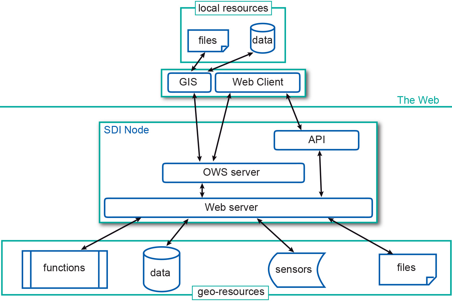
Once services have been implemented for different SDI nodes, a common practice is to facilitate their access by building portals. Spatial web portals can be thought of as a gateway that provides access to geo-resources via geo-webservices on the Web. A web portal is simply a website that gives visitors organized access in a unified way, typically through catalog services, to geo-resources on the Web, and preferably also to the people and organizations offering those geo-resources (see Figure 1). A portal potentially offers access to many other sites. Consequently, a web portal can also be used to aggregate content.

Learning outcomes
-
19 - SDI Environment
Describe and apply the basic processes, processing, analysis and conversion in an SDI environment while combining multiple data sets from various remote sensing and other sources and explain challenges in data integration. Describe and use various methods of change detection. (Max. level 3)
Prior knowledge
Outgoing relations
- Web Portal is part of Web 2.0
- Web Portal is used by Spatial Data Infrastructure (SDI)