Vector Overlay
Introduction
In the vector domain, overlay is computationally more demanding than in the raster domain. Here we will only discuss overlays from polygon data layers, but do note that most of the ideas also apply to overlay operations with point or line data layers.
Explanation
The standard overlay operator for two layers of polygons is the polygon intersection operator. It is fundamental, as many other overlay operators proposed in the literature or implemented in systems can be defined in terms of it. The principles are illustrated in Figure 1a. The result of this operator is the collection of all possible polygon intersections; the attribute table result is a join of the two input attribute tables. This output attribute table only contains one tuple for each intersecting polygon found, which explains why we call this operator a spatial join.

The second is known as the polygon clipping operator (Figure 1b). It takes a polygon data layer and restricts its spatial extent to the generalized outer boundary obtained from all (selected) polygons in a second input layer. Besides this generalized outer boundary, no other polygon boundaries from the second layer play a role in the result.
The third overlay operator is referred to as polygon overwrite (Figure 1c). The result of this binary operator is a polygon layer with the polygons of the first layer, except where polygons exist in the second layer, as these take priority.
Most GISs do not force the user to apply overlay operators to the full polygon data set. One is allowed to first select relevant polygons in the data layer and then use the selected set as an operator argument. The fundamental operator of all these is polygon intersection. The other operators can be defined in terms of it, usually in combination with polygon selection and/or classification. For instance, the polygon overwrite of A by B can be defined as polygon intersection between A and B, followed by a (well-chosen) classification that prioritizes polygons in B, followed by a merge. (The reader is asked to verify this.) Vector overlays are usually also defined for point or line data layers. Their definition parallels the definitions of operators discussed above. Different GISs use different names for these operators, so it is advisable to carefully check the documentation before applying any of these operators.
Examples
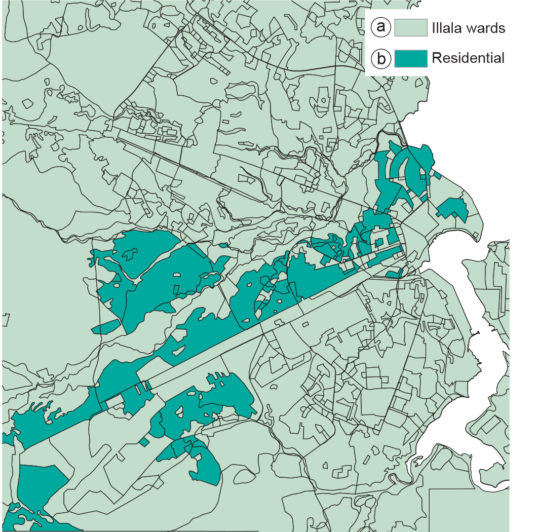
A more practical example is provided in Figure 2, which was produced by polygon intersection of the ward polygons with land use polygons. This allows us to select the residential areas in Ilala District.
Learning outcomes
-
11 - Spatial analysis: classes of functions
Classify and explain spatial analysis functions (measurements, classification, overlay, neighbourhood and connectivity) in a raster and vector environment (level 1 and 2).
Prior knowledge
Outgoing relations
- Vector Overlay is a kind of Overlay Analysis
- Vector Overlay is used by Vector Representation