Spatial-Temporal data model
Introduction
The way we represent relevant components of the real world in our models determines the kinds of questions we can or cannot answer. We have already discussed representation issues for spatial features, but so far we have ignored issues for incorporating time. The main reason is that GISs still offer limited support for doing so. As a result, most studies require substantial efforts from the GIS user in data preparation and data manipulation. Also, besides representing an object or field in 2D or 3D space, the temporal dimension is of a continuous nature. Therefore, in order to represent it in a GIS we have to discretize the time dimension.
Spatio-temporal data models are ways of organizing representations of space and time in a GIS. Several representation techniques have been proposed in the literature. Perhaps the most common of these is the “snapshot state”, which represents a single moment in time of an ongoing natural or man-made process. We may store a series of these “snapshot states” to represent “change”, but we must be aware that this is by no means a comprehensive representation of that process. Further treatment of spatio-temporal data models is outside the scope of this book and readers are referred to Langran (1992) for a discussion of relevant concepts and issues.
Examples
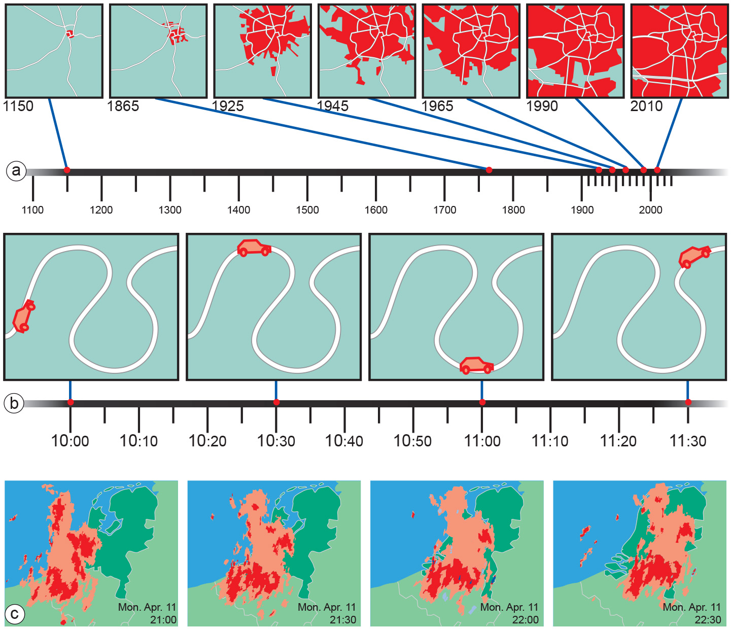
In spatio-temporal analysis we consider changes of spatial and thematic attributes over time. We can keep the spatial domain fixed and look only at the attribute changes over time for a given location in space. We might be interested how land cover has changed for a given location or how land use has changed for a given land parcel over time, provided its boundary has not changed. On the other hand, we can keep the attribute domain fixed and consider the spatial changes over time for a given thematic attribute. In this case, we might want to identify locations that were covered by forest over a given period of time.
Finally, we can assume both the spatial and attribute domains are variable and consider how fields or objects have changed over time. This may lead to notions of object motion - a subject receiving increasing attention in the literature. Applications of moving object research include traffic control, mobile telephony, wildlife tracking, vector-borne disease control and weather forecasting. In these types of applications, the problem of object identity becomes apparent. When does a change or movement cause an object to disappear and become something new? With wildlife this is quite obvious; with weather systems less so. But this should no longer be a surprise: we have already seen that some geographic phenomena can be nicely described as objects, while others are better represented as fields.
External resources
- Langran, G. (1992). Time in geographic inormation systems. Technical issues in geographic information systems (1). London, United Kingdom: Taylor & Francis.
Learning outcomes
-
2 - Spatial data modelling: computer representations
Explain and be able to apply basic vector and raster spatial data structures including selecting a suitable data structure for geographic phenomena (level 1, 2 and 3).
Prior knowledge
Outgoing relations
- Spatial-Temporal data model is a kind of Geographical representation
- Spatial-Temporal data model is based on Temporal attribute