Map generalization
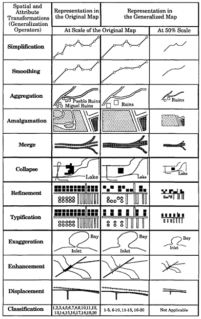
Map generalization is the process that simplifies the representation of geographical data to produce a map at a certain scale with a defined and readable legend. To be readable at a smaller scale, some objects are removed; others are enlarged, aggregated and displaced one to another, and all objects are simplified. During the process, the information is globally simplified but stays readable and understandable. [1]
Introduction
Why is Generalization Necessary?
- Scale Reduction – A map at a smaller scale (e.g., 1:1,000,000) cannot show the same level of detail as a large-scale map (e.g., 1:10,000).
- Improved Readability – Reducing clutter makes maps easier to interpret.
- Data Storage & Processing Efficiency – Simplified data reduces computational load in digital mapping.
- Highlighting Important Features – Ensures that key elements stand out while less significant details are omitted.
Explanation

Examples of map generalization operators [3]
Examples

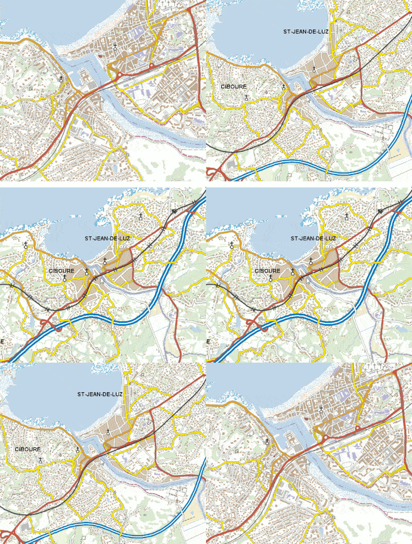
Example of multi-scale generalization results from IGN, France [2]
Synonyms
Cartographic generalization
External resources
- [1] Ruas, A. (2008). Map Generalization. In: Shekhar, S., Xiong, H. (eds) Encyclopedia of GIS. Springer, Boston, MA. https://doi.org/10.1007/978-0-387-35973-1_743
- [2] ICA Commission on Generalisation and Multiple Representation.
- [3] Shea, S. K., and McMaster, R. B. (1989) Cartographic generalization in a digital environment: When and how to generalize, Proceedings of AutoCarto, Vol. 9.
- [4] Li, Z. (2006). Algorithmic foundation of multi-scale spatial representation. CRC Press.
Outgoing relations
- Map generalization is subconcept of Cartography
Incoming relations
- Map resolution is a kind of Map generalization
- Cartographic generalization is same as Map generalization