Geometric Operations
Explanation
If you did not know so before, after reading the Chapter on "Spatial referencing and satellite-based positioning" you will know that the Earth has a spherical shape and that several clever scientists have devised transformations to map the curved Earth’s surface to a plane. Through a map projection (transformation) we can obtain an image of the Earth’s surface that has convenient geometric properties.
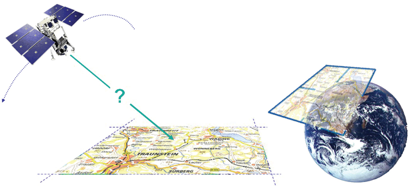
We can, for instance, measure angles on a map and use these for navigation in the real world, or for setting out a designed physical infrastructure. Or if, instead of a conformal projection such as UTM, we use an equivalent projection, we can determine the size of a parcel of land from the map—irrespective of where the parcel is on the map and at which elevation it is on the Earth. A remote sensor “images” the Earth’s surface without knowledge of map projections, so we must not expect that remote sensing images have the same geometric properties as a map. Moreover, wherever a remote sensor detects, it merely records DNs. DNs do not come with a label that tell us where exactly on the Earth is the corresponding ground-resolution cell to be found (Figure below).
Outgoing relations
- Geometric Operations is modelled by Georeferencing